Property & location overview
Show the building, grounds and immediate surroundings when the website needs visitors to understand the full setting.
For selected Create23 website projects, aerial photography and short drone video can help visitors understand a property, venue, business location or surrounding context. It is planned as website content, not sold here as a standalone drone service.
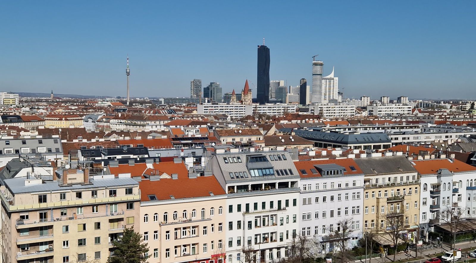
Aerial imagery can show scale, surroundings, access and spatial relationships that are difficult to communicate from ground level. On a website, that can help a visitor understand the place faster.
The drone is not the product. It is one possible camera position inside a website project. If the story is stronger from the ground, we stay on the ground.
“The aerial view earns its place when it explains something the website otherwise cannot.”Explore Create23 websites →
Aerial content is chosen according to the pages and sections being built. There is no separate drone package to fill.
Show the building, grounds and immediate surroundings when the website needs visitors to understand the full setting.
Help explain approach, orientation or spatial relationships that are difficult to see from street level.
Short aerial motion used selectively when movement and scale add useful context to a website hero or location section.
Additional website imagery that can complement founder, team, workplace and ground-level location photography.
We first decide what the site needs to communicate. Only then do we determine whether aerial content adds enough value to justify planning a flight.
Aerial content is planned only after the exact location is checked. Austro Control DroneSpace is the primary Austrian source for current airspace and geographical-zone information, and it is also where pilots can access operator-registration functions and the official A1/A3 drone-licence process.
Check the exact location, current airspace structures and geographical zones before relying on an aerial shot.
Apps & licenceSee the official DroneSpace app, ÖAMTC Drohnen-Info, the A1/A3 online course and the Austrian government drone overview.

A practical planning guide for the checks, restrictions and location-specific questions that matter before considering an aerial website shot.
Read the drone rules guide →
See how founder, team, workplace and location photography can be planned around the same website project.
See website photography →The website remains the project. Aerial imagery is one optional content layer inside it.
Aerial photography and video on this website are currently offered as part of or in connection with selected Create23 website projects.
Yes, where both formats have a clear use on the website and the location-specific flight is feasible and lawful.
Yes. Aerial content is only planned after checking the location-specific constraints that apply to the intended operation. A website content idea does not automatically mean a drone flight is possible.
The material is created primarily for the website. Where appropriate, selected images or clips can also be reused in other business communication.
Start with the website and the location story. If an aerial perspective makes that story clearer, we can plan the necessary photo or video into the project and check feasibility before anything is scheduled.